

- Best time to visit
- All year round
- Distance from Reykjavík
- 175km (109mi)
- GPS Coordinates
- 64.82296, -23.38498
A former trading post on southern Snæfellsnes
The name Búðir means “booths”, a reference to the trading and fishing huts that once stood here. For centuries this was the most active trading centre on the south coast of Snæfellsnes, as well as a working fishing station. Archaeological remains along the shore at Frambúðir point to activity reaching back to the settlement era. In 1703, around 120 people were registered in the parish. The trade declined through the nineteenth century and the community was eventually abandoned.
Búðir sits in the municipality of Snæfellsbær, in the district historically known as Staðarsveit. Nothing of the old settlement survives above ground apart from the church and its graveyard.
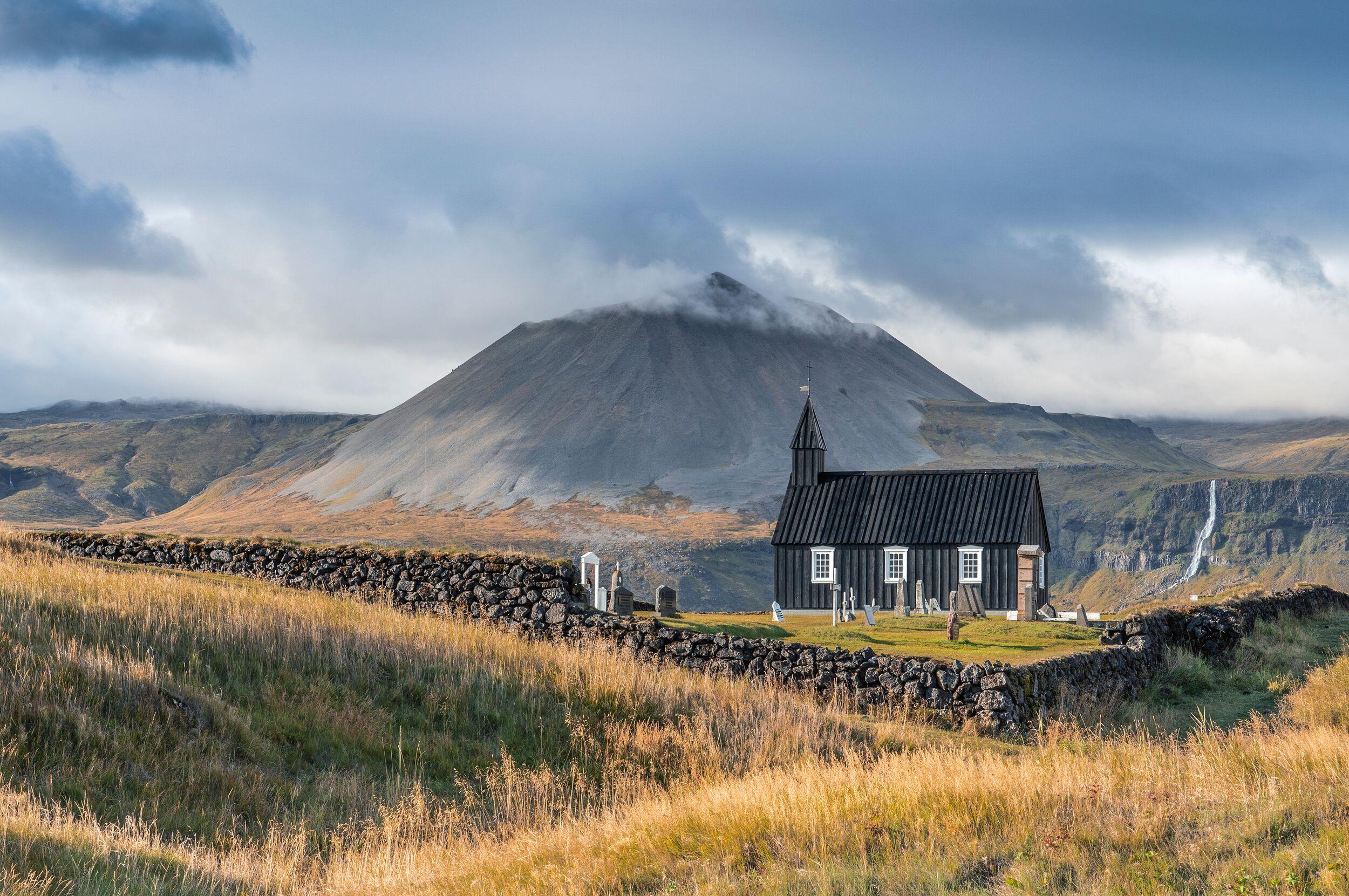
Búðakirkja, the black church
The first church at Búðir was built in 1703 — a small turf church with a graveyard alongside it. Burials have taken place at Búðir since 1705. Over time the building fell into disrepair, and in 1816 the parish was abolished by royal letter on account of the church’s condition.
Steinunn Sveinsdóttir, a widow living at Búðir in the mid-nineteenth century, applied to the church authorities for permission to rebuild. She led the project and paid for it herself. Construction of the timber church finished in 1848, though it was not consecrated until 1851. Steinunn died in 1854 at the age of 77 and is buried in the graveyard at Búðir, where her gravestone still stands.
The church has been altered and repaired many times since. The most recent reconstruction was in 1987, when local people worked with specialists including staff from the National Museum of Iceland to return the building to its 1848 form. Its dark exterior comes from the pitch traditionally used to protect timber from Icelandic weather.
Visiting the church
Búðakirkja is still in use for parish events and is a popular venue for weddings. Practical details worth knowing before you arrive:
- A single room of roughly 5 by 9 metres, with seating for up to 50 people
- An organ inside, and two bells in the tower
- No heating, no toilet and no running water
- The graveyard is active and in use — please treat it accordingly
The Búðahraun lava field
The church stands on Búðahraun, a lava field that reaches east to the sea at Faxaflói and west to the reef at Hraunlandarif. The lava came from Búðaklettur, an 88-metre crater in the middle of the field, and flowed roughly 5,000 to 8,000 years ago. Older manuscripts call the lava field Klettshraun.
The eastern part of Búðahraun was designated a nature reserve in 1977, covering just over 1,000 hectares. It is unusually well vegetated for an Icelandic lava field: around 130 species of vascular plant have been recorded here, including 11 of the 16 fern species found in Iceland. The reserve is administered together with Snæfellsjökull National Park. Stay on the marked paths — the moss and vegetation are slow to recover from footfall.
Walking routes from Búðir
Several marked trails start at or near the church. Times below are one way unless stated.
- Búðakirkja to Frambúðir, the old anchorage and trading site — about 30 minutes
- Búðir – Búðaklettur – Miðhús — 4 to 6 km, 2 to 3 hours
- Búðir to Miðhús via Jaðargata — 6 km, 2 to 3 hours
- Búðir along the coast to Arnarstapi — a long day’s walk of 6 to 8 hours
The waterfall Bjarnarfoss is visible on the slopes above Búðir, and the coast here is a good spot for birdwatching in summer. Seals are sometimes seen offshore.